Expeditions are differentiated from multi-day trips in terms of duration and difficulty.
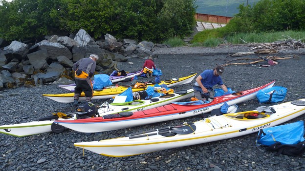
Expeditions tend to entail being in the sea kayaks for a longer period of time between stops, likely to encounter slightly more challenging conditions due to exposure, longer crossings, and shoreline with more fetch. These trips are designed for people with some experience, skills training, and backcountry camping skills who are interested in exploration and developing/furthering previously developed skills.
Below are some Expeditions and sample itineraries to consider:
-Columbia Bay
-Advance and Retreat
-Cross Sound
-Northwestern Prince William Sound
-Southwestern Prince William Sound
-Exploratory
Columbia Bay 6 or 8 Day
6 Day
Day 1) An Early a.m. departure from Whittier for a chartered drop off at Granite Point on the far eastern edge of Wells Bay. As soon as we round Granite Point you can see straight to the Gulf of Alaska through Hinchinbrook Entrance. Welcome to northcentral Prince William Sound! The openness and exposure is one of my favorite aspects to this part of the Sound. At any point during this trip Humpback and/or Orca whales are definitely possible.
We’ll load our kayaks have a great lunch and depart for Glacier Island. Weather permitting we will go around the south side of Glacier Island and set camp. There are puffins, sea lions, seals, ice, diverse geological formations and sea caves.
Day 2) A Hearty Breakfast, break camp, load the kayaks and work our way around the rest of Glacier Island. In the process we will pass by a massive sea lion haul out and work our way through a maze of ice. Before crossing to the mainland we’ll stop for lunch and then head on to Elf Point where well make camp for the night.
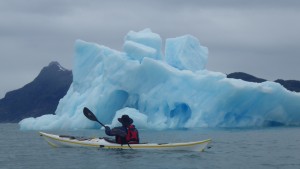
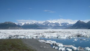
Day 3) Basecamp! Instead of breaking camp and loading the kayaks, we’ll leave camp set, pack our gear for the day, and paddle towards the moraine that encompasses the most amazing collection of giant icebergs in Prince William Sound. It is not possible to get to the face of the glaciers at the head of the fjord as there is about 10 miles of packed icebergs. We will paddle in and among the giant bergs, hike around to gain various perspectives and explore, looking for a variety of shore birds and land creatures.
Day 4) Once again it’s time to break camp, load our kayaks and travel back to Glacier Island where we will make camp. Because of the exposure to the Gulf we might need to paddle the north side both coming and going to Columbia Glacier. Weather dictates our trip!
Day 5) Break camp and work our way along the Island back to Granite Point. We will still be accompanied by the ice and puffins dropping out of the cliff or cave walls taking flight just before hitting the water. The geology changes yet again as we work the mainland shoreline.
Day 6) This is our day to sleep in, relax and do a bit more exploring to either Granite Bay which has tremendously steep walls where mountain goats can be seen, or a paddle around Fairmont Island.
Ultimately this allows us a day to ride out bad weather and might be utilized somewhere else in the trip.
8 Day
This trip will be identical to the 6 day however we will have a couple extra days to explore Granite and Cedar Bays- the northernmost cedar trees, Fairmont and Little Fairmont Islands, or we might alter our trip while in Columbia Bay to explore Long Bay and work our way back along the mainland shoreline to Granite Point. Again this affords us a day for weather if necessary and greater potential for exploration. Taking a few extra days out here is highly suggested as there is so much spectacular terrain to explore and so much energy is spent getting out this far.
The charter boat service as well as fiberglass doubles or plastic singles are included in this trip.
For a full explanation of the differences between the types of trips and what else is included click on either heading.
Unakwik Inlet to Columbia Glacier: Advance and Retreat
This is called the “advance and retreat trip” because we will visit Meares glacier which is one of two tidewater glaciers advancing in Prince William Sound. We will also travel as far as possible toward Columbia Glacier which is the fastest retreating Glacier in Prince William Sound. The retreat has been so fast that it is impossible to paddle to the face of Columbia Glacier because upon its retreat it left behind a terminal moraine that entraps miles of massive icebergs.
Day 1) The trip starts with an early a.m. charter to Brilliant Glacier deep into Unakwik Inlet. We will get dropped off, set up camp, have lunch and then paddle around the corner to one of the few tidewater glaciers that are still advancing in Prince William Sound. After spending the afternoon watching the ice calve off Meares Glacier, paddling among the seals and ice, and scanning the shoreline for black bears and Sitka blacktail deer, we will head back to camp for a great warm and hearty dinner and a well earned nights’ sleep.
Day2 ) After breakfast and hot drinks we will break camp and make our way south along the eastern shoreline to a camp somewhere along the way. We will be paddling as near as you can get above water to the epicenter of the 1964 Good Friday Earthquake that devastated southcentral Alaska and radically altered Prince William Sound.
Day 3) We will continue south along the eastern shore of Unakwik Inlet. There is a fisheries hatchery on this shoreline so we might get a chance to see the commercial fishermen in action! The south end, Unakwik Point, is far from the glaciers and therefore far from the glacial silt which obscures the water hindering sunlight from penetrating and stimulating growth. Here the water is clear, offering spectacular shoreline paddling and tide pooling.
Ultimately we are headed to Granite Point. If time, energy and weather allow, we will explore Granite and Cedar Bays before making camp.
Cedar Bay is incredibly as it is home to the northern and westernmost extension of the Alaskan Yellow Cedar tree’s range.
Granite Bay has dramatic cliff walls- likened to a mini-Yosemite where mountain goats can be seen foraging and climbing around. In the back of the bay are streams where thousands of salmon come to spawn in later summer.
If we are unable or choose not to explore these bays on our way to Granite Point then we will have the chance to visit them on our way back before our scheduled charter back to Whittier.
Days 4-9) From here the schedule will be the same as the 6-8 day trip to Columbia Glacier.
Day 4) As soon as we round Granite Point you can see straight to the Gulf of Alaska through Hinchinbrook Entrance. Welcome to northcentral Prince William Sound! The openness and exposure is one of my favorite aspects to this part of the Sound. At any point during this trip Humpback and/or Orca whales are definitely possible.
We’ll load our kayaks have a great lunch and depart for Glacier Island. Weather permitting we will go around the south side of Glacier Island and set camp. There are puffins, sea lions, seals, ice, diverse geological formations and sea caves.
Day 5) Break camp, load the kayaks and work our way around the rest of Glacier Island. In the process we will pass by a lively sea lion haul out, check out the pillow basalt formations and work our way through a maze of ice. Before crossing to the mainland well stop for lunch and then head on to Elf Point where well make camp for the night.
Day 6) Basecamp! Wake up have, breakfast and instead of breaking camp and loading the kayaks we’ll leave camp set, pack lunches, snacks and all the appropriate gear for the day and paddle towards the moraine that encompasses the most amazing collection of gigantic icebergs in Prince William Sound. It is not possible to get to the face of the glaciers at the head of the fjord as there is about 10 miles of packed icebergs. We will paddle in and among the giant bergs, hike around to gain various perspectives and explore, looking for a variety of shore birds and land creatures.
Day 7) Once again it’s time to break camp, load our kayaks and travel back to Glacier Island where we will once again make camp. My hope on these trips is to circumnavigate the island by paddling the opposite side of our first encounter with Glacier Island. Because of the exposure to the Sound and the Gulf, we might need to paddle the north side both coming and going to Columbia Glacier. Weather dictates our trip!
We will camp on Glacier Island.
Day 8) Break camp and work our way along the Island back to Granite Point. We will still be accompanied by the ice and puffins dropping out of the cliff or cave walls taking flight just before hitting the water. The geology changes yet again as we work the mainland shoreline.
Day 9) This is our day to sleep in and relax, do a bit more exploring to Granite Bay and Cedar Bay, go for a paddle around Fairmont and Little Fairmont Islands or take a hike into the temperate rainforest. Perhaps some combination!
Ultimately this allows us a day to ride out bad weather and might be utilized somewhere else in the trip.
Day 10) We will meet our charter mid-day for the ride back to Whittier.
The charter boat service as well as fiberglass doubles or plastic singles are included in this trip.
Cross Sound Expedition
Valdez to Whittier or Whittier to Valdez Trip
The paddle from Whittier to Valdez is incredible on so many levels. Abundant wildlife, massive ice choked fjords, varying geology, distance paddling, pristine water which allows you to peer deep under water, rock gardening –maneuvering with the swell in and among the rocks, big steep mountain walls, sheltered and exposed coastline; these are all just a few of the things that make this trip spectacular.
For a glimpse at some of the highlights of our trip please go to the links below which my friend Drew put together for us.
www.trousdellcollections.com/valdez/trip.swf
If for some reason this link doesn’t work go to the gallery page.
This above link provides a day by day visual journal of some of what we experienced along the way!
Please also look at the Columbia Glacier trip below for more description.
This will be a 13 day trip which allows for 2 days of weather delays and a day for travel back to Whittier. If we have perfect weather we can do more exploring or potentially go in early.
The plan at the moment is to paddle from Whittier to Valdez. Ultimately I reserve the right to change plans based on what the immediate and extended forecast looks like. The ferry schedule accommodates either plan.
Ideally we will be paddling around 15 miles per day on average. Some days may require more, some days less. Some days we might want to paddle more, some days less.
On my trip last year we took 3 of us 8 days to paddle 154.5 miles which averages to 19.3 miles per day with no layover/weather or basecamp days=breaking camp every morning. Our shortest day was 12.8 miles- coming into Whittier (we ran out of water to paddle and I think we were all okay with that). The longest was 23.6 miles.
My philosophy is to “push on” to see and explore as much along the way as possible. Weather always dictates so it might be in our best interest to push on rather than get stuck, or it may be best to sit tight in a nice camp rather than push on and weather a storm in a less than ideal spot. This is the trick with all trips.
The loose itinerary if paddling from Whittier to Valdez will be:
(roughly opposite if Valdez to Whittier)
Meet at a yet to be determined time as a group well in advance of the trip to discuss the dynamics and logistics of the trip- to dial everything in.
Day 1) Depart Whittier in the morning, camp somewhere at least at the mouth of Passage Canal, if not a bit beyond.
Days 2-4) There is an option to “Island Hop” ie. go south along Culross, Perry, The Dutch Group and Axel Lind Islands, or north along Esther Island and the northern mainland. Either route will ultimately come together at the mainland of the western entrance to Unakwik Inlet.- this is another potential basecamp day so that we can explore Granite and it’s “half dome” geology, and Cedar Bays -home to the northern and western most extension of the Alaskan Yellow Cedar tree’s range!
Day 5) From Unakwik Inlet we will work our way to Glacier Island. – Here comes the Ice! Once we leave Unakwik/Wells Bays we will encounter ice until we start heading into Valdez Arm. This is also when we start to really encounter the possible swell that makes its way through Hinchinbrook Entrance from the Gulf of Alaska. There are numerous opportunites to play in and among the rocks swell or not! There is a lively sea lion haul out on the south side of Glacier Island so you can count on them to accompany us along this stretch.
Day 6) Glacier Island to Elf Point
Day 7) Day trip into Columbia Bay- likely a basecamp day
Days 8-10) We will work our way through Valdez Arm, Valdez Narrrows, and into Port Valdez with a visit to Shoup Glacier.
Days 11&12) These days may be utilized elsewhere in the trip to accomodate weather, basecamp days, extra exploration along the way, or tagged onto the end to explore Jack Bay.
After this final day, (day 12), we will spend the night in the town of Valdez, not far from the ferry terminal. The following morning we will catch the ferry back to Whittier viewing all that we paddled along the way.
I offer similar but additional description to this trip in the other trips below with overlapping sections.
Exploratory Expeditions
New Evans Island to Naked Island
The plan is to catch the ferry to Sawmill Bay from Whittier. From there we will cross to the south end of Knight Island with the hope of paddling the eastern shoreline. We will explore the cluster of islands at the north end of Knight and then cross to the southwest corner of Naked Island. From here we will explore Naked, Storey and Peak Islands. At the end we will catch our charter boat back to Whittier.
This is an exploratory trip that I have been wanting to do for a while now. Requirements are at least level 3 sea kayaking skills and backcountry camping skills. This is an instructional escorted trip, please click on the link for more information.
I can provide sea kayaks and paddling gear, and camping gear as needed. Cooking duties will be shared.
Prerequisites:
Be able to paddle for 15 miles per day, without getting out of the boat for up to 3-4 hours. Be comfortable in Beaufort force 3-4 conditions, 2-3 ft seas, winds 11-16 knots . Be confident with self-rescues, assisted rescues, towing, maneuvering skills ie. bow rudder, side slip/hanging draw, stern rudder, draw on the move – there will be lots of opportunities to play. Being a competent member of a group as we will paddle together as a group each and every day. Have backcountry camping and cooking skills especially managing yourself and gear in the rain, potentially for many rainy days. You will need to have knowledge of how to pack your kayak, how to cook and plan meals for yourself or in cooking group for up to 13 days. We will break into cooking groups to minimize redundancy.
Ideally 3 star BCU, Level 3 ACA, NOLS and/or Outward Bound sea kayaking course.
Additionally experience with backcountry camping is helpful.
Included in this trip:
Leadership
Local knowledge
Safety
Logistics
Satellite phone for emergency use only
USFS and State Permits
This is an escorted, not a guided trip. What does this mean?
You are responsible for your own: rainproof tent, synthetic sleeping bag, sleeping pad, crockery, stove and fuel, tarps, rain gear, clothing, tow line, compass and charts, drybags*, paddling gear*-drysuit, paddle and spare, pump, pfd, booties, sound kayak, spray skirt, food shopping, packing and preparation.
Any of this can be provided for an additional fee.
If you have been taking sea kayaking courses or training on your own, and looking to do a trip which allows you to use all you’ve learned and build upon your skills, this is the trip you’ve been looking for.
Gear
If you do not have your own bombproof drysuit, booties, and helmet, kayak with appropriate safety features: sound bulkheads, decklines and toggles and all the appropriate accessories: pump, paddle + spare and spray skirt, then we can provide them for an additional fee:
Kokatat drysuit, helmet, and booties
Snap Dragon Sprayskirts
Werner Paddles
NDK/SKUK, P&H, and Seaward singles and doubles are available for rent. Please see our rental page.

